Introduction
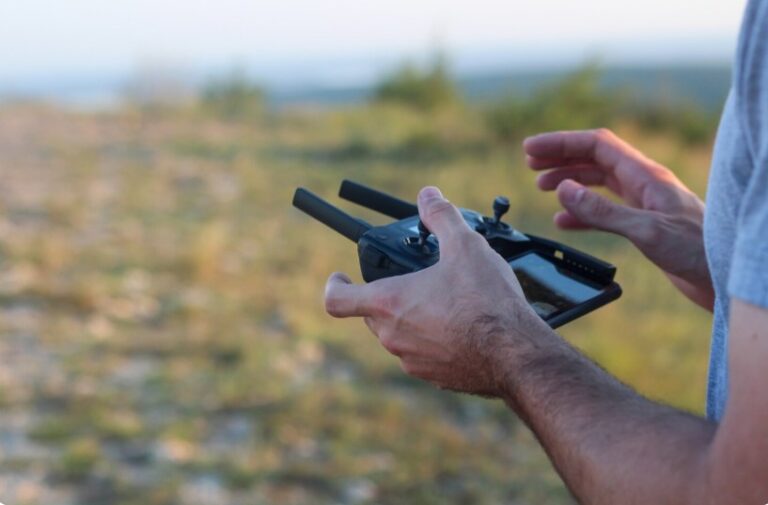
Environmental monitoring has become more important than ever as industries, governments, and researchers work to protect natural resources and manage climate-related challenges. Traditional surveying methods often require large teams, expensive equipment, and significant time to gather accurate environmental data. However, technological innovation has introduced a more efficient solution: drones with LiDAR.
LiDAR, which stands for Light Detection and Ranging, is an advanced remote sensing technology that uses laser pulses to measure distances and generate highly accurate 3D maps of the earth’s surface. When integrated with drones, LiDAR technology becomes a powerful tool for collecting environmental data quickly, safely, and accurately.
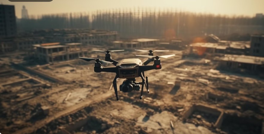
Today, drones with LiDAR are being used in forestry management, flood monitoring, wildlife conservation, coastal analysis, agriculture, mining reclamation, and disaster response. These intelligent systems help environmental professionals gain detailed insights into landscapes that are difficult or dangerous to access manually.
As businesses and organizations seek smarter environmental solutions, companies like Gulfnet recognize the growing importance of advanced aerial technologies in sustainable development and environmental protection.
This article explores the role of drones with LiDAR in environmental monitoring, their benefits, applications, challenges, and future potential across various industries.
Understanding Drones with LiDAR Technology
Before exploring environmental applications, it is important to understand how drones with LiDAR work.
LiDAR systems emit thousands of laser pulses every second toward the ground. These pulses bounce back after hitting objects such as trees, buildings, water surfaces, or terrain. The system then measures the return time of each pulse to calculate precise distances and elevations.
Mounted on drones, LiDAR sensors can capture highly detailed topographic and environmental data from the air. Unlike traditional photogrammetry, LiDAR can penetrate vegetation and collect ground-level information even in dense forests.
The main components of drones with LiDAR include:
- Drone platform
- LiDAR sensor
- GPS system
- Inertial Measurement Unit (IMU)
- Data processing software
Together, these components create highly accurate 3D environmental models that support scientific analysis and decision-making.
Importance of Environmental Monitoring
Environmental monitoring involves observing and assessing environmental conditions over time. This process helps researchers and policymakers understand ecosystem health, identify environmental threats, and develop sustainable management strategies.
Monitoring is essential for:
- Forest conservation
- Water resource management
- Climate change studies
- Biodiversity protection
- Disaster prevention
- Soil erosion analysis
- Pollution detection
- Coastal management
Traditional monitoring methods often involve manual surveys, satellite imagery, or aircraft-based inspections. While effective, these methods can be costly, time-consuming, and limited in accuracy.
This is where drones with LiDAR provide significant advantages.
Key Benefits of Drones with LiDAR in Environmental Monitoring
1. High Accuracy Data Collection
One of the biggest advantages of drones with LiDAR is their ability to capture highly accurate elevation and terrain data. LiDAR sensors can measure tiny variations in the landscape, making them ideal for environmental studies.
This level of precision helps researchers:
- Detect subtle terrain changes
- Monitor erosion patterns
- Analyze vegetation density
- Map flood-prone areas
Accurate data improves environmental planning and reduces errors in decision-making.
2. Faster Surveying Process
Traditional land surveys can take days or weeks to complete. In contrast, drones with LiDAR can survey large areas within a few hours.
This rapid data collection is especially valuable during:
- Natural disasters
- Flood assessments
- Wildfire monitoring
- Emergency response situations
Faster surveys allow organizations to react quickly and implement solutions efficiently.
3. Access to Difficult Terrain
Environmental monitoring often requires surveying remote or hazardous areas such as:
- Dense forests
- Mountains
- Wetlands
- Coastal cliffs
- Disaster zones
Sending human survey teams into these environments can be risky and expensive. Drones with LiDAR can safely access these locations while collecting accurate data from above.
4. Vegetation Penetration Capability
Unlike standard aerial photography, LiDAR can penetrate vegetation layers and capture ground elevation beneath forests.
This capability is critical for:
- Forest management
- Archaeological discovery
- Soil analysis
- Terrain mapping
Environmental researchers can study landscapes hidden beneath tree canopies with remarkable detail.
5. Cost Efficiency
Using manned aircraft for aerial surveys can be extremely expensive. Drones with LiDAR significantly reduce operational costs by requiring fewer personnel, less fuel, and shorter survey times.
Organizations can achieve high-quality results while staying within budget.
Applications of Drones with LiDAR in Environmental Monitoring
Forest Management and Conservation
Forests play a critical role in maintaining ecological balance and reducing carbon emissions. Monitoring forest health is essential for sustainable management.
Drones with LiDAR help forestry professionals:
- Measure tree height and canopy density
- Estimate biomass and carbon storage
- Detect illegal logging activities
- Identify disease outbreaks
- Monitor deforestation trends
LiDAR-generated forest models provide detailed insights that improve conservation planning.
Flood Risk Assessment
Flooding is one of the most common natural disasters worldwide. Accurate terrain analysis is essential for predicting flood behavior and minimizing damage.
Using drones with LiDAR, environmental agencies can:
- Map floodplains
- Analyze drainage systems
- Identify vulnerable regions
- Develop flood mitigation strategies
High-resolution elevation models improve flood forecasting accuracy and support emergency planning.
Coastal Monitoring
Coastal regions face increasing threats from:
- Sea level rise
- Coastal erosion
- Storm surges
- Habitat destruction
Drones with LiDAR help monitor shoreline changes and coastal ecosystems with exceptional precision.
Environmental experts use LiDAR data to:
- Measure beach erosion
- Analyze dune systems
- Monitor mangrove forests
- Study coastal habitat changes
These insights support long-term coastal protection strategies.
Wildlife Habitat Mapping
Protecting wildlife habitats requires accurate environmental information. Drones with LiDAR help conservationists understand habitat conditions without disturbing animals.
Applications include:
- Habitat mapping
- Migration route analysis
- Vegetation assessment
- Wetland monitoring
LiDAR data supports biodiversity conservation and ecosystem restoration projects.
Wetland Analysis
Wetlands are among the most valuable ecosystems on Earth, but they are also highly vulnerable to environmental damage.
Drones with LiDAR help scientists:
- Monitor water levels
- Map wetland boundaries
- Assess vegetation health
- Study hydrological patterns
Detailed wetland data supports environmental restoration and protection programs.
Monitoring Climate Change Effects
Climate change is causing significant environmental transformations worldwide. Researchers use drones with LiDAR to monitor these changes over time.
LiDAR technology assists in:
- Glacier monitoring
- Coastal erosion studies
- Forest loss tracking
- Sea-level rise analysis
By comparing data collected over multiple years, scientists can better understand climate-related environmental changes.
Mining Site Rehabilitation
Mining activities can significantly impact natural ecosystems. Environmental regulations often require mining companies to restore affected land after operations end.
Drones with LiDAR support rehabilitation efforts by:
- Measuring land disturbances
- Monitoring vegetation recovery
- Assessing erosion control measures
- Creating terrain models
Mining companies can track environmental restoration progress more effectively.
Agricultural Environmental Monitoring
Modern agriculture increasingly relies on environmental monitoring to improve sustainability and productivity.
Drones with LiDAR help farmers and agricultural specialists:
- Analyze soil conditions
- Monitor irrigation systems
- Assess crop health
- Detect drainage issues
These insights contribute to precision agriculture and resource conservation.
How LiDAR Data Is Processed
Collecting LiDAR data is only the first step. The information must be processed into usable environmental models.
The typical workflow includes:
- Data Collection
- GPS and IMU Synchronization
- Point Cloud Generation
- Terrain Classification
- 3D Modeling
- Environmental Analysis
Processed LiDAR data can produce:
- Digital Elevation Models (DEMs)
- Digital Terrain Models (DTMs)
- Vegetation maps
- Flood simulations
- Forest canopy models
Advanced software tools transform raw LiDAR data into actionable environmental intelligence.
Comparing LiDAR Drones with Traditional Surveying Methods
Traditional Surveying
Traditional environmental surveying often involves:
- Ground crews
- Manual measurements
- Satellite imagery
- Helicopter surveys
Although effective, these methods have limitations:
- Time-consuming
- Expensive
- Limited accessibility
- Lower data density
Drones with LiDAR
Compared to conventional methods, drones with LiDAR offer:
- Faster data collection
- Higher accuracy
- Lower operational costs
- Improved safety
- Better terrain penetration
As a result, many industries are shifting toward drone-based environmental monitoring solutions.
Challenges of Using Drones with LiDAR
Despite their advantages, drones with LiDAR also face certain challenges.
High Initial Investment
LiDAR sensors and professional drones can be expensive. High-quality systems require significant upfront investment.
However, long-term operational savings often justify the cost.
Complex Data Processing
LiDAR generates massive amounts of data that require specialized software and expertise to process effectively.
Organizations may need trained professionals for:
- Point cloud analysis
- GIS integration
- 3D modeling
Regulatory Restrictions
Drone operations are subject to aviation regulations in many countries.
Operators may require:
- Flight permissions
- Pilot certifications
- Restricted airspace approvals
Compliance is essential for safe and legal drone operations.
Weather Limitations
Extreme weather conditions can affect drone performance.
Challenges include:
- Strong winds
- Heavy rain
- Poor visibility
Careful planning is necessary for successful environmental surveys.
Future of Drones with LiDAR in Environmental Monitoring
The future of drones with LiDAR looks highly promising as technology continues to evolve.
Several trends are expected to shape the industry:
Artificial Intelligence Integration
AI-powered analysis tools will help automate environmental data interpretation, making monitoring faster and more efficient.
Improved Sensor Technology
Future LiDAR sensors will become:
- Smaller
- More affordable
- More accurate
- Energy efficient
This will expand adoption across industries.
Real-Time Environmental Monitoring
Advanced drones may soon provide real-time environmental analysis during flights, enabling instant decision-making during disasters and emergencies.
Expanded Smart City Applications
Urban planners are increasingly using drones with LiDAR for:
- Green infrastructure planning
- Urban flood management
- Environmental impact assessments
Smart city initiatives will drive further demand for drone-based environmental monitoring.
Why Businesses Are Investing in Drones with LiDAR
Organizations across industries recognize the value of accurate environmental data.
Businesses invest in drones with LiDAR because they provide:
- Better operational efficiency
- Improved environmental compliance
- Enhanced risk management
- Reduced surveying costs
- Faster project completion
Technology-focused companies like Gulfnet understand the importance of adopting innovative solutions that support sustainability and environmental responsibility.
Best Practices for Using Drones with LiDAR
To maximize the effectiveness of environmental monitoring projects, organizations should follow best practices such as:
- Conducting proper flight planning
- Using high-quality sensors
- Ensuring accurate GPS calibration
- Training drone operators
- Following regulatory requirements
- Regularly maintaining equipment
These practices help ensure reliable data collection and successful environmental analysis.
Conclusion
Environmental monitoring is essential for protecting ecosystems, managing natural resources, and addressing climate-related challenges. Traditional surveying methods, while useful, often struggle to provide the speed, accuracy, and accessibility needed for modern environmental analysis.
This is why drones with LiDAR have become a revolutionary solution across industries. Their ability to collect highly accurate 3D environmental data quickly and safely makes them invaluable for forestry management, flood assessment, coastal monitoring, wildlife conservation, agriculture, and disaster response.
As LiDAR technology continues to advance, drone-based environmental monitoring will become even more powerful, affordable, and widely adopted. Organizations that invest in these innovative technologies will gain better environmental insights, improve sustainability efforts, and make smarter decisions for the future.
Companies such as Gulfnet recognize the growing importance of advanced environmental technologies and the role they play in building a more sustainable and resilient world.
The future of environmental monitoring is being shaped by intelligent aerial systems, and drones with LiDAR are leading the way toward more efficient, accurate, and environmentally responsible solutions.